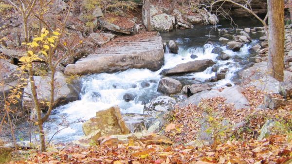
Laurel Point. TRAIL CHANGE

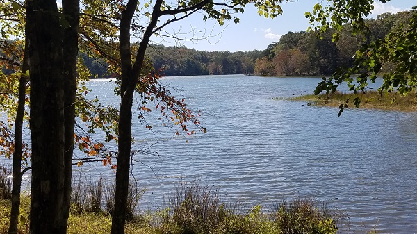
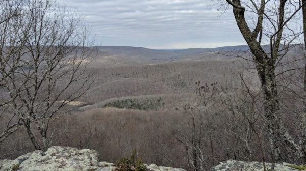
Saturday, December 2 — Raccoon Mountain: Laurel Point and several trails. Shorter hike 4 miles, longer hike an extra 3 miles or so, both easy—we’ll be hiking entirely atop the mountain with very little elevation change. It is almost all in the woods, with a couple of brief open spots on the trail that provide some […]

Lookout Mountain

Tuesday, December 5 — Lookout Mountain: Hardy Trail, Mountain Beautiful Trail, Bluff Trail, Craven’s House Trail, loop, 3.9 miles, easy/moderate, 731’ el. gain. We'll start at Cravens House and wind our way across and up the east side of Lookout Mountain, go under the Point Park Bluff and back around to Cravens House. Since it is December, we […]

Gilbert Gaul Trail plus Woodcock Cove

Saturday, December 9 — Gilbert Gaul Loop, Fall Creek Falls State Park, 4.5 miles, loop, easy to moderate, 100’ el. gain. Following this hike, there will also be an optional exploratory hike to Woodcock Cove climbing trails above Dunlap, around 3-5 miles, with one short but steep section. The first hike to Gilbert Gaul Loop has rolling hills, with […]

Sherwood Forest

Tuesday, December 12 — Sherwood Forest, 2.7 miles, loop, easy. We will see impressive rock formations and a nice view of the steep railroad track where the trains needed pusher engines to chug up the mountain. Naturalists should look for the rare Painted Snake Coiled Forest Snail (!!) which has only been found in Franklin […]

Franklin State Forest

Saturday, December 16 — Franklin State Forest South Rim loop, 6.3 miles, moderate, 662’ el. gain. This hike west of South Pittsburg takes us through a hardwood forest to a southeastern edge of the Cumberland Plateau, overlooking coves and eaten out by gulches. For carpooling/caravanning, meet at 8:30 am ET at the parking lot just after LaQuinta Inn, […]

Enterprise South Nature Park

Tuesday, December 19 – Enterprise South Nature Park: Poe Run Path, Upper Poe Run, Poe Run Overlook, Deer Hollow, and Hidden Lake Trails, easy to moderate, approximately 4 miles, el. gain 420’. Enjoy this beautiful park, which was once the site of the Volunteer Army Ammunitions Plant. We will check out one of the open […]

Boyd Gap plus Scenic Spur Trail

Saturday, December 23 — Boyd Gap to Brush Creek Trail in the Cherokee National Forest, 6 miles, moderate, 600’ el. gain, plus an optional second hike on the Scenic Spur Trail, starting at the foot of Chilhowee Mountain, 3.3 miles, easy, 393’ el. gain. The first hike involves an easy shuttle, a few creek crossings […]

Summit Knobs Trail

Tuesday December 26 — Summit Knobs Trail, about 5 miles, easy, in-and-out. This hike bobs up and down gentle hills as it makes its way to Harrison Branch creek, our turnaround point. The full name of the trail is Summit Knobs Equestrian Trail—we’ll have to watch our step! Restrooms are available. For carpooling/ caravanning, meet at […]

Laurel Falls+Natural Bridge CANCELLED: Road closed until 2024

Saturday, December 30 — Laurel Falls, Bryan Overlook, and a hidden natural bridge, about 8 miles, moderate, about 900’ el. gain, out-and-back. We’ll walk by interesting remnants of mining activity along wild and wooly Richland Creek and take switchbacks to Laurel Falls, which is almost always impressive. We’ll then head up a steep trail to […]

CT: Board Camp Creek

Board Camp Creek, about 8 miles, moderate. Short shuttle. We'll start this hike at the Soddy Gulf trailhead in Soddy-Daisy. A flat one-mile walk along Big Soddy Creek takes us to Board Camp Creek (what a weird name!), which we cross to get to the Cumberland Trail. This section of the CT roughly follows Board […]

White Oak Mountain

Tuesday, January 2 – White Oak Mountain trails just north of Chattanooga, approximately 4.5 miles, moderate, about 630’ el. gain. We’ll hike Dogwood, Krebs Cycle, Black Bear, and parts of Big Red and Christmas Top trails. Enjoy these beautiful trails, which are part of the Southern Adventist University campus but open to the public. We […]

Hinch Mountain

Saturday, January 6 — Hinch Mountain Section of the Cumberland Trail, 8 to 9 miles, out-and-back, moderately strenuous. Starting at Stinging Fork Falls trailhead, we will explore this new section of the Cumberland Trail that turns off Stinging Fork trail and heads north towards Hinch Mountain. We will cross Stinging Fork Creek and Little Soak Creek, descend a rock stairway, walk through a pine forest, and ascend the gorge. We will return by retracing our steps. Check the weather forecast and choose […]

polygon(703 1, 703 1, 695 1, 694 4, 676 5, 668 5, 664 5, 638 7, 638 7, 620 8, 608 8, 567 10, 567 10, 551 10, 551 10, 530 12, 525 13, 525 13, 505 13, 503 13, 460 13, 459 13, 444 13, 419 12, 419 12, 417 12, 406 13, 377 13, 361 13, 343 12, 343 12, 326 11, 313 13, 297 12, 272 12, 268 12, 268 12, 250 13, 225 13, 220 13, 207 13, 207 10, 194 9, 189 9, 191 28, 155 27, 153 27, 128 26, 126 26, 84 26, 78 26, 73 26, 68 26, 68 43, 60 58, 60 58, 51 77, 55 87, 52 87, 51 87, 49 88, 49 88, 48 88, 40 103, 35 125, 15 135, 20 141, 20 141, 20 142, 21 166, 21 166, 21 166, 20 168, 10 174, 2 176, 0 179, 0 180, 50 182, 56 182, 81 182, 94 183, 94 183, 109 183, 125 183, 128 183, 162 183, 164 183, 178 183, 196 182, 196 182, 227 183, 260 183, 261 183, 292 184, 296 184, 336 183, 336 183, 374 183, 396 183, 407 183, 416 183, 424 182, 448 181, 448 181, 462 181, 465 181, 465 181, 478 180, 503 180, 505 157, 512 152, 521 152, 525 150, 527 147, 532 129, 532 129, 533 130, 556 117, 556 117, 557 117, 558 118, 570 117, 571 117, 586 107, 590 103, 590 101, 590 101, 614 91, 618 76, 622 75, 630 69, 635 64, 637 63, 639 62, 640 62, 641 63, 641 63, 642 65, 642 65, 651 70, 657 60, 673 51, 673 51, 685 55, 696 38, 697 36, 698 34, 702 30, 707 28, 707 28, 707 27, 708 29, 710 30, 711 30, 711 30, 713 29, 713 24, 715 3, 718 1)