McGregor Park to Fort Defiance

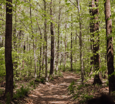
2.7 miles Easy Out and Back After the hike we can eat lunch at Wendy's. The whole hike is paved. We walk along both the Cumberland and Red Rivers, cross the Red River on a highway sidewalk and hike up switchbacks through the woods to the Fort's Museum. There are a couple of vistas overlooking […]

Canceled Cancelled – Fiery Gizzard North and Dog Hole Trail

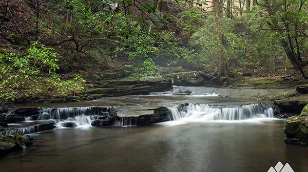
Thursday, May 2 – Fiery Gizzard North and Dog Hole Trail. South Cumberland State Park, near Tracy City, TN. 8.5-10 miles depending on how many overlooks and waterfalls we include and rated difficult. Early morning start, exact time determined closer to the hike date. All day and expect around 7 hours hiking. The Fiery Gizzard […]

Canceled Cancelled – Fiery Gizzard North and Dog Hole Trail

Thursday, May 2 – Fiery Gizzard North and Dog Hole Trail. South Cumberland State Park, near Tracy City, TN. 8.5-10 miles depending on how many overlooks and waterfalls we include and rated difficult. Joint hike with Murfreesboro chapter. Early morning start, exact time determined closer to the hike date. All day and expect around 7 […]

Tims Ford State Park Hike

Thursday, May 2 – Tims Ford State Park, Winchester, TN.  Lost Creek Overlook Trail and a section of the Ray Branch Overlook Trail.  5 miles.  Easy.  Nice views of Tims Ford Lake while hiking over rolling hills in a mature hardwood forest.  Contact Joan Hartvigsen to register, jhartvigs@comcast.net or 931-636-2914. Meet at 9 am at […]

Bear Creek Loop, Land Between the Lakes

6.6 miles Moderate The trail is on natural turf through the woods and a couple of grassy fields, There are a couple of creek crossings near the end of the hike where you might get your feet wet. Trekking poles are recommended. Dogs are permitted if on a leash. There is a restroom and a […]

Short Springs Work Day

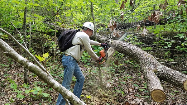
Saturday, May 4 – Short Springs Workday.  Meet at 8:00 am in the Short Springs parking lot, 2250 Short Springs Road, Tullahoma.  Bring work gloves, trash bag, pruner and loppers.  Specific tasks will be announced Saturday, May 4 – Short Springs Workday.  Meet at 8 am in the Short Springs parking lot, 2250 Short later.  […]

Chickamauga Battlefield

Saturday, May 4 — Chickamauga Western Loop, Chickamauga Battlefield, 6.4 miles, easy/moderate, 442’ el. gain. This is a pleasant hike, sometimes on roads and sometimes on wide trails. Monuments, woods, fields, more monuments, more woods. The visitors’ center is full of information about this battle as well as the succeeding battle at Chattanooga. Pay tribute […]

Rich Mountain in Cades Cove, Smoky Mtns.

Approximately 8 1/2 mile loop trail. Rated moderate-difficult due to length & elevation changes (1736 feet elevation). Jeff Chambers will lead us on a hike where we will see several meadows that may be carpeted with wildflowers such as black-eyed Susan, butterfly weed, purple phacelia, jewelweed, daisies and mountain laurel. Possibly see wildlife of deer, […]

Jones Mill Trail

Jones Mill Trail Long Hunter State Park 9933 Barnett Rd, Mount Juliet, TN, United States

Long Hunter State Park 8 miles. Moderately strenuous for length. This is a hiker-friendly biking trail with little elevation change which features lake views, cedar glades and barrens, other types of terrain, and wildflowers. Bring plenty of water and snacks. We’ll meet at the Jones Mill trailhead for an 8:30 AM step-off. Register with Mark […]

Walk in the Woods: Kirkstone Trail            

Distance: 2.0 miles (loop). Rating: Moderate The Kirkstone Trail is a moderate trail and approximately a 2.0 mile loop hiking trail along gravel roads. The trailhead is at the junction of Marmaduke and Christopher a little way up the hill from the spillway on Lake Kirkstone. The route is marked with yellow stakes and directional […]

Johnston Woods

Tuesday, May 7— Johnston Woods Trails, about 4 miles, easy/moderate, 269’ elevation gain. We will hike two generally easy loop trails through the forest, taking in lovely views, multiple fungi, and (we hope) colorful wildflowers. The trails are wide and well-marked, good for yakking away with your hiking buddies. The upper trail is about 3 miles; then […]

polygon(703 1, 703 1, 695 1, 694 4, 676 5, 668 5, 664 5, 638 7, 638 7, 620 8, 608 8, 567 10, 567 10, 551 10, 551 10, 530 12, 525 13, 525 13, 505 13, 503 13, 460 13, 459 13, 444 13, 419 12, 419 12, 417 12, 406 13, 377 13, 361 13, 343 12, 343 12, 326 11, 313 13, 297 12, 272 12, 268 12, 268 12, 250 13, 225 13, 220 13, 207 13, 207 10, 194 9, 189 9, 191 28, 155 27, 153 27, 128 26, 126 26, 84 26, 78 26, 73 26, 68 26, 68 43, 60 58, 60 58, 51 77, 55 87, 52 87, 51 87, 49 88, 49 88, 48 88, 40 103, 35 125, 15 135, 20 141, 20 141, 20 142, 21 166, 21 166, 21 166, 20 168, 10 174, 2 176, 0 179, 0 180, 50 182, 56 182, 81 182, 94 183, 94 183, 109 183, 125 183, 128 183, 162 183, 164 183, 178 183, 196 182, 196 182, 227 183, 260 183, 261 183, 292 184, 296 184, 336 183, 336 183, 374 183, 396 183, 407 183, 416 183, 424 182, 448 181, 448 181, 462 181, 465 181, 465 181, 478 180, 503 180, 505 157, 512 152, 521 152, 525 150, 527 147, 532 129, 532 129, 533 130, 556 117, 556 117, 557 117, 558 118, 570 117, 571 117, 586 107, 590 103, 590 101, 590 101, 614 91, 618 76, 622 75, 630 69, 635 64, 637 63, 639 62, 640 62, 641 63, 641 63, 642 65, 642 65, 651 70, 657 60, 673 51, 673 51, 685 55, 696 38, 697 36, 698 34, 702 30, 707 28, 707 28, 707 27, 708 29, 710 30, 711 30, 711 30, 713 29, 713 24, 715 3, 718 1)