Graysville Mountain CANCELLED due to all-day rain and thunderstorms

Saturday, January 27 — Graysville Mountain,9 miles, moderate with rocky terrain, 900’ el. gain. Shuttle required. On this section of the Cumberland Trail, we will hike through the woods to the top of Graysville Mountain, then continue all the way to Hwy 30, with the last bit just recently completed. Highlights include an old mining area, […]

Big Creek Gulf CANCELLED – RAIN

South Cumberland State Park: Big Creek Loop. 9.9 miles, strenuous due to descent into and ascent out of Big Creek Gulf, 1,620’ elevation gain. We will make a loop using Greeter Trail, Big Creek Gulf Trail, connector trail, and Big Creek Rim trail. Cliffs, creeks, waterfalls, vistas! Check the forecast and choose appropriate layers, wear […]

Turtletown Falls/Coker Creek Falls

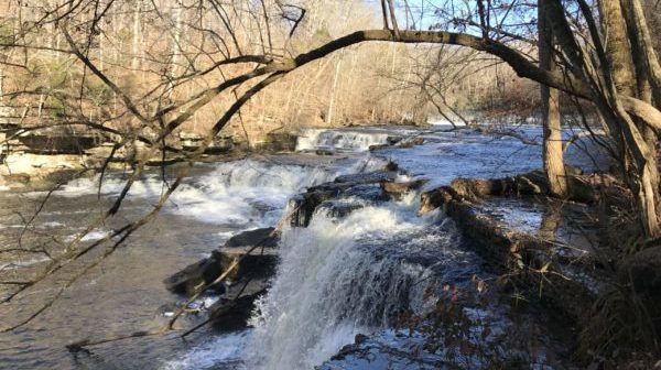
Saturday, February 24 — SHORTER HIKE: Turtletown Falls Trail, 5.2 miles, 730’ el. gain, lollypop, moderate. LONGER HIKE: After the Turtletown Falls hike, drive to Coker Creek Falls Trail for an out-and-back hike, for a total of 9.9 miles, 1320’ el. gain, moderate/strenuous. Turtletown Falls Trail is well maintained, winds through a beautiful forest, and […]

Graysville Mountain

Saturday, March 2 — Graysville Mountain, 9 miles, moderate with rocky terrain, 900’ el. gain. Shuttle required. On this section of the Cumberland Trail, we will start at the Roaring Creek Trailhead and travel along the creek before heading up rocky switchbacks to the top of Graysville Mountain, then continue all the way to Hwy 30, […]

Laurel-Snow: Laurel Falls & Natural Bridge

Saturday, March 16 — Laurel Snow SNA. Joint hike with the Chattanooga Hiking Club (CHC), two options. LONGER: Laurel Falls and a natural bridge, about 9 miles and 1200’ el. gain, out-and-back, moderate/strenuous. SHORTER: Laurel Falls, 4.7 miles, 708’ el. gain, out-and-back, moderate. We will all start out on the mostly flat trail along Richland […]

Big Frog Mountain

Saturday, April 6 — Big Frog Mountain Trail, 10.8 miles, 2319’ el. gain, strenuous, out-and-back. This trail near the Ocoee River climbs to the top of Big Frog Mountain, sometimes more steeply and sometimes less so. Forested the entire way, including at the top, the trail has few views, but travels through a lovely forest. […]

Benton McKaye Trail to Hiwassee River

Tuesday, April 30 — Benton McKaye Trail: Lost Creek Campground to the Hiwassee River, 4.1 miles, easy. Requires shuttle. This is an especially outstanding section of the Benton McKaye Trail, which parallels Big Lost Creek through a deep limestone gorge with cascades and waterfalls. The trail follows an old railroad grade built for logging in […]

Virgin Falls

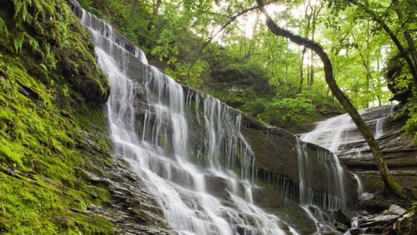
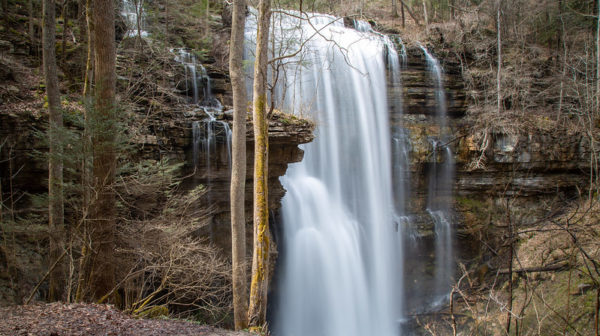
Saturday, May 18 — Virgin Falls Trail, about 9 miles out-and-back, strenuous with about 1400’ of elevation gain, with a lonnggg uphill on the way back. Near Sparta TN. This is an amazing waterfall! In addition, there are more waterfalls on the creek we follow to get down into the Caney Fork River gorge. This is a […]
CT: Hall Road Trailhead

Saturday, June 29 — Hall Road section of the Cumberland Trail, Signal Mountain TN, out-and-back, about 8 miles, maybe 800-1,000’ elevation gain, moderate to strenuous due to distance and elevation gain; or a second option of turning back around the 3-mile mark, for a 6-mile hike.  This section is complete but not yet listed on the CTC website, so the elevation change is […]

Lookout Mtn: Cravens House Loop

Tuesday, July 2 — Lookout Mountain, Chattanooga: Cravens House loop trail, 3 miles or so, 640’, el. gain, moderate. Trees, rocks, cliffs, views, museum, history! We will go up the mountain on the gradual Cravens House Trail, then north toward Point Park on the always scenic Bluff Trail. Just below the Point is an interesting […]

Emery Creek Falls

Saturday, July 6 — Emery Creek Falls Trail near Chatsworth, GA. Moderate, 5.9 miles, 900’ el. gain, out and back. This is a highly rated “adventurous” trail with many creek crossings, so bring good water shoes, preferably sturdy enough for hiking. The two-step set of waterfalls at the turnaround point is just great! Check the weather […]

Virgin Falls

Saturday, July 20 — Virgin Falls Trail, about 9 miles out-and-back, 1200’ of elevation gain, strenuous because of a lonnggg uphill on the way back. Near Sparta TN. This is an amazing waterfall! In addition, there are more waterfalls on the creek we follow to get down into the Caney Fork River gorge. This is a really interesting […]

polygon(703 1, 703 1, 695 1, 694 4, 676 5, 668 5, 664 5, 638 7, 638 7, 620 8, 608 8, 567 10, 567 10, 551 10, 551 10, 530 12, 525 13, 525 13, 505 13, 503 13, 460 13, 459 13, 444 13, 419 12, 419 12, 417 12, 406 13, 377 13, 361 13, 343 12, 343 12, 326 11, 313 13, 297 12, 272 12, 268 12, 268 12, 250 13, 225 13, 220 13, 207 13, 207 10, 194 9, 189 9, 191 28, 155 27, 153 27, 128 26, 126 26, 84 26, 78 26, 73 26, 68 26, 68 43, 60 58, 60 58, 51 77, 55 87, 52 87, 51 87, 49 88, 49 88, 48 88, 40 103, 35 125, 15 135, 20 141, 20 141, 20 142, 21 166, 21 166, 21 166, 20 168, 10 174, 2 176, 0 179, 0 180, 50 182, 56 182, 81 182, 94 183, 94 183, 109 183, 125 183, 128 183, 162 183, 164 183, 178 183, 196 182, 196 182, 227 183, 260 183, 261 183, 292 184, 296 184, 336 183, 336 183, 374 183, 396 183, 407 183, 416 183, 424 182, 448 181, 448 181, 462 181, 465 181, 465 181, 478 180, 503 180, 505 157, 512 152, 521 152, 525 150, 527 147, 532 129, 532 129, 533 130, 556 117, 556 117, 557 117, 558 118, 570 117, 571 117, 586 107, 590 103, 590 101, 590 101, 614 91, 618 76, 622 75, 630 69, 635 64, 637 63, 639 62, 640 62, 641 63, 641 63, 642 65, 642 65, 651 70, 657 60, 673 51, 673 51, 685 55, 696 38, 697 36, 698 34, 702 30, 707 28, 707 28, 707 27, 708 29, 710 30, 711 30, 711 30, 713 29, 713 24, 715 3, 718 1)