May 25 @ 9:00 am – 5:00 pm
We will be hiking the Lilly Bluff Overlook Trail, Boulder Trail and Point Trail at the Obed National Wild and Scenic River area in Lancing TN.
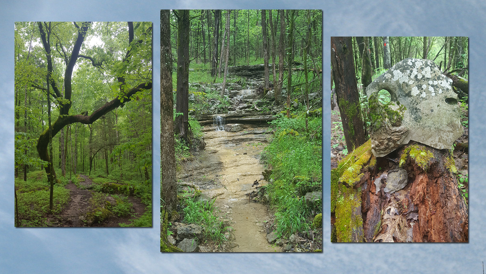
The National Park Service describes the Lilly Bluff Overlook trail as an easy 0.3 mile “stroll through hemlock forest to a great overlook of the Clear Creek Gorge”. The Boulder Field Trail leaves the Lilly Bluff overlook parking area and winds through HUGE boulders and impressive stands of Hemlock (0.4 miles). The Point Trail is a 3.8 mile moderate roundtrip hike culminating “on the narrow, exposed ridge that separates the Obed River from Clear Creek before the two flow together.” Poles are advised as there is one small stretch of steepness and a small water crossing.
We will meet and depart at Books A Million, 310 South Illinois Avenue in Oak Ridge at 9 am to carpool to Trailhead. Please arrive in time to leave at 9 am. If you prefer to drive and meet us at the Lilly Bluff Overlook Parking Lot (there is plenty of parking) you will likely not have phone service. Please know ahead of time where we’re meeting – have a backup plan in case you lose gps service. The coordinates are 36.102525, -84.721554. There are restrooms at the Overlook Parking Lot. We will plan to depart trailhead at 10:00 am EST
We have two options in the area for lunch. Lillypad Hopyard Brewery(drink) and Sauced Frog (food) OR Moco Brewery in Wartburg (drink) with lunch delivered from next door Tanner’s Historic Café. Alternatively, we can return to Oak Ridge and eat there.
To register for the hike contact Kathy Taylor at khtaylor1031@comcast.net or
865-679-5335.
Kathy Taylor
865-679-5335
khtaylor1031@comcast.net